  |
Southern ScotlandThe Merrick
|
  |
Photographs of an ascent of The Merrick
the
highest of the Corbetts
in the
Galloway Hills
of the Borders Region of Scotland
Bruce's
Stone above Loch Trool
at the start of the ascent route to The Merrick The Bruce's Stone commemorates the victory in Glen Trool of Robert the Bruce over the forces of Edward II of England |
 Inscription
on Bruce's Stone
The Bruce's Stone commemorates the victory in Glen Trool of Robert the Bruce over the forces of Edward II of England |
Waterfall
in the Buchan Burn
on the ascent route to The Merrick |
Buchan Hill
above the ascent route to The Merrick |
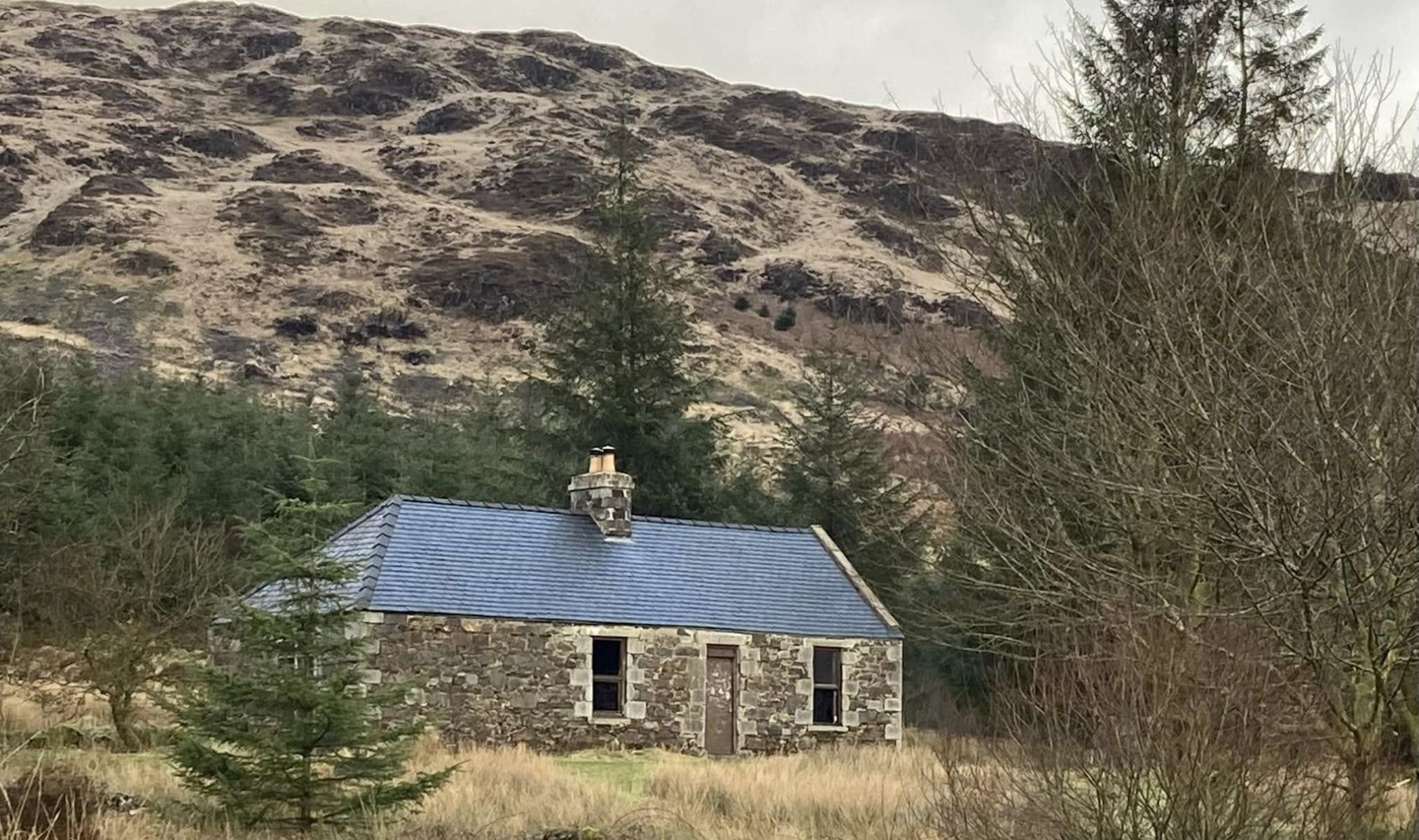
Culsharg bothy
beneath Benyellary on the ascent route to The Merrick |
 Culsharg bothy
beneath Benyellary on the ascent route to The Merrick |
The
Merrick ( 843m, 2,766ft )
from Benyellary |
The
Corbett Shalloch on Minnoch
from the trig point on The Merrick ( 843m, 2,766ft ) The Merrick is the highest summit in the Southern Uplands and the highest in Scotland south of Ben Lomond Views also extend from the summit to Ailsa Craig and the Isle of Arran in the Firth of Clyde and south to the Solway Firth |
The
Merrick from Kirrieroch
Hill
The " Awful Hand " range runs from The Merrick to Shalloch on Minnoch |
Galloway
Hills
and Lochs
from The Merrick |
 Galloway
Hills
and Lochs
from The Merrick |
Redstone
Rig on The
Merrick
an alternative ascent / descent route via the "Old Grey Man" rock outcrop |
 "Old
Grey Man" rock
outcrop
|
 Map of
The Merrick
( Note: Click here or on map for larger copy ) |
MERRICK - ROUTE DESCRIPTION:
MERRICK - ROUTE DESCRIPTION 2:
Location: Dumfries & Galloway
Map: OS Landranger 77
Distance: 10 miles / 16km
Time: 5-6 hours
Terrain: Moderate hill walk
The Range of the Awful Hand, it's a wonderful name for a wonderful little grouping of southern hills, the highest of which, The Merrick at 2764ft / 843m dominates the hills around Loch Trool.
Merrick, the “branched finger" of the Awful Hand, is the highest summit in Galloway.
The route approaches the Merrick via the four lochs ( or maybe five: the largest island on Loch Enoch has a loch of its own ) to the east of the hill and then
follows the hill‘s long eastern ridge, Redstone Rig, to the summit.
The monumental Bruce’s Stone at the start of the walk commemorates a clash with English forces in 1307 when Robert the Bruce was beginning his campaign for Scottish independence.
This was an area he knew well and the broken hillsides and scattered woodland of Glcn Trool were ideal for his style of guerilla warfare.
From the Bruce's Stone car park, the road drops downhill towards a bridge at the bottom, where a sign indicates the Buchan Burn.
Ignore this sign and instead cross another stile on the left where a sign points towards Loch Valley and the Gairlant Burn.
The route gains height quickly now as it diagonally crosses a field on the face of Buchan Hill, towards a gate in the wall at the top of the field.
Once over the gate you find yourself in a hanging valley that contains the Gairland Burn with the path following the tumbling waters of the burn as it chuckles its
way between the old glacial moraines, rising steadily to the outflow from Loch Valley.
Here lies a different world, harsher and more open. From the outflow follow the western shore of the loch on a good path which then continues
to climb onto a new level, one which contains the waters of Loch Neldricken.
A wet and indistinct path follows the south-west shores of the loch and crosses a wall by the area known as the Murder Hole.
This area of deep water in Loch Neldricken features in SR Crockett's book The Reivers a novel of cattle reiving and murder.
Apparently, this stretch of water never freezes over.
The path now runs alongside a wall which follows the western slopes of Ewe Rig to the smaller Loch Arron, the next in our rosary of lochs.
Continuing steadily upwards, the route leads to a small col which overlooks the dark and brooding Loch Enoch, complete with its reflections of Mullwharchar which rises beyond.
A curious name in an area of curious names, Mullwharchar is apparently derived from the Gaelic Maol Adhairce, meaning the Hill ofthe Huntsman's Horn.
The waters of Loch Enoch lie in a high granite basin which caress the 500m contour. Beyond its southwestern shores, the long line of Redstone Rig
can be seen rising steadily to the Merrick's summit.
At 2764ft / 843m, the Merrick is the highest hill in Scotland south of Ben Lomond and all the effort of the ascent is worthwhile with wide views in all directions.
A grassy descent contours the Neive of the Spit and a short rise leads to the cairm on Benyeilary, the eagle's hill.
Follow the path steadily downhill beside the Whitehead Burn to the bothy at Culsharg.
From here a path and forestry track heads south, alongside the Buchan Burn, back to the car park in Glen Trool.