Photographs
of The Saddle
and Sgur nan Forcan ridge
in Glen Shiel
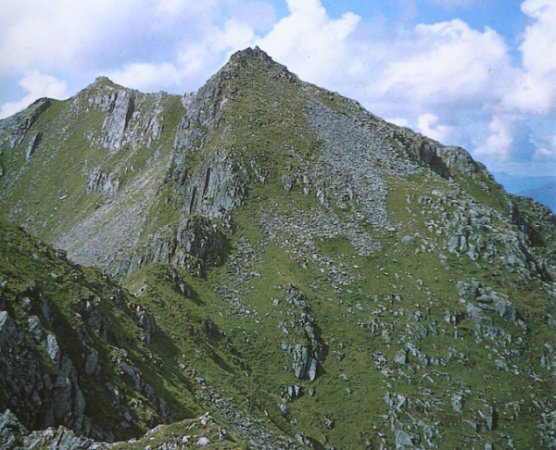
The
Saddle (
3314ft, 1010m )
from
Sgurr
nan Forcan
The
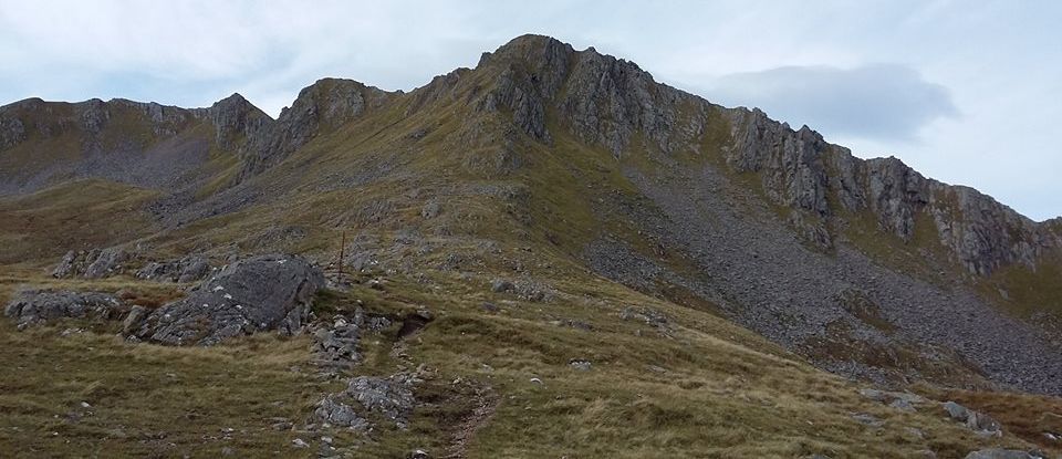
traverse of the Forcan Ridge,
in winter or summer,
is one of
the
classic mountain expeditions
in Scotland.
The mountain's name
refers to
the shape
of the summit ridge,
when seen from Glen
Shiel,
with the
twin
summits and ridge in between
resembling a saddle.
|
|

The Saddle
|
|

Forcan
Ridge
on The Saddle
|
|

Forcan
Ridge
|
|
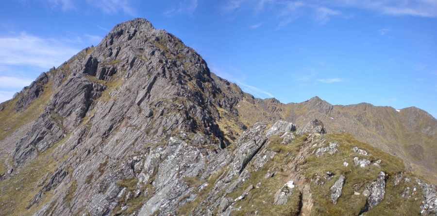
Forcan
Ridge
on The Saddle
|
|

Forcan
Ridge
on The Saddle
|
|

Forcan
Ridge
on The Saddle
|
|

Forcan
Ridge
|
|

The
Saddle (
3314ft, 1010m )
|
|

The
Saddle
|
|

The Brothers
Ridge
and The
Saddle
|
|

The
Saddle (
3314ft, 1010m )
|
|
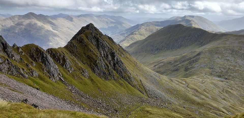
The Saddle
|
|

Trig Point
on The Saddle
|
|

The Saddle and
Forcan
Ridge
|
|
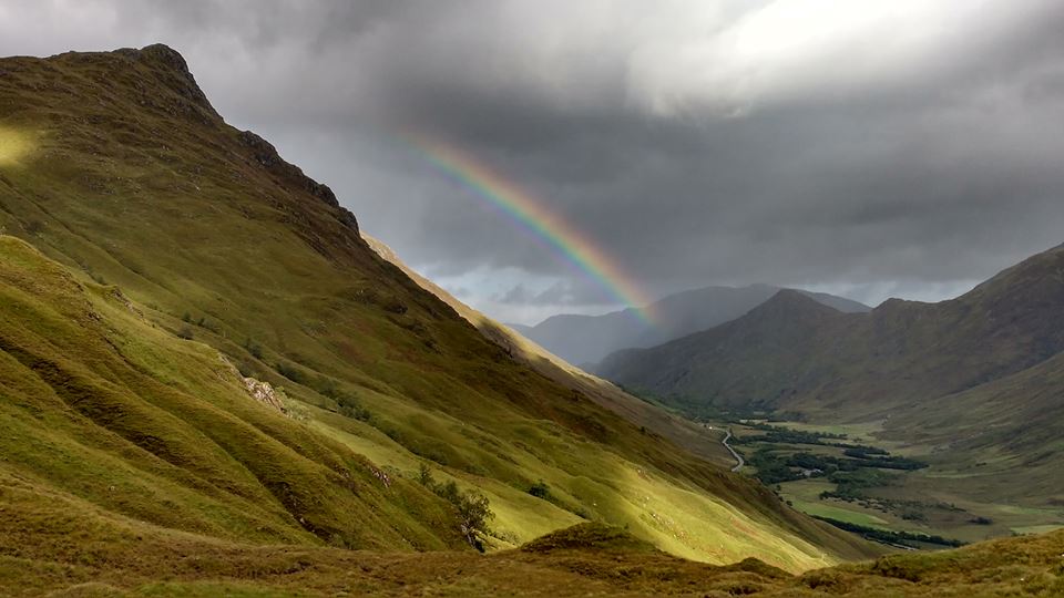
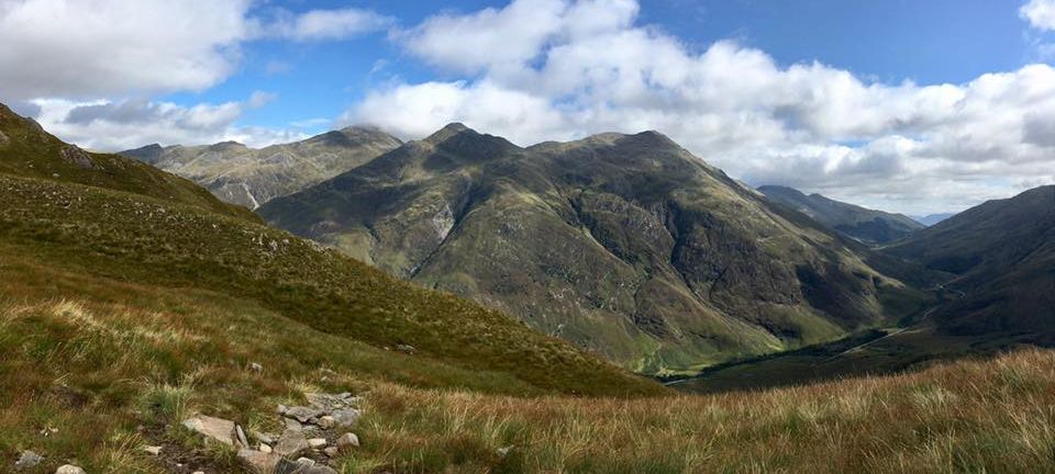
Glen Shiel
|
|

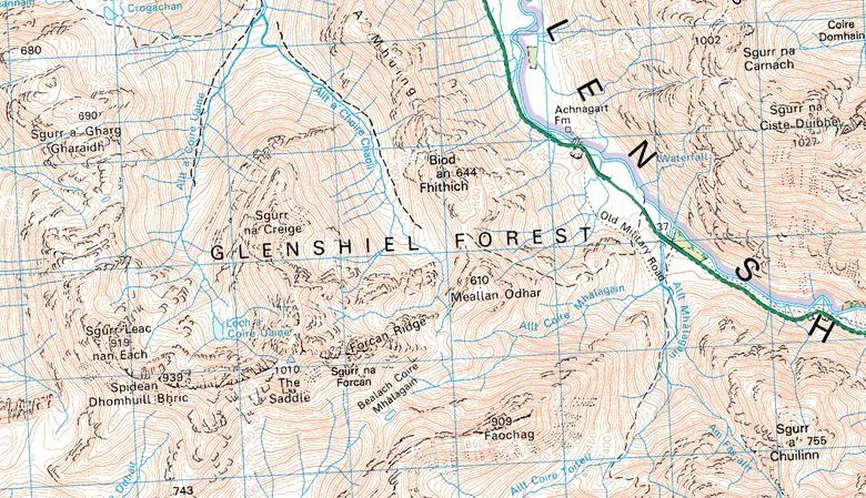
Map for
The Saddle
|
|
Route description
for The
Saddle:
Location: Kintail
Grade: Serious
mountain walk. A mountaineering route
in full winter conditions
Distance:
10miles / 16km
Time: 7-8 hours
An Diollaid is the
finest mountain in one of Scotland’s
most Munro-rich areas. The name
describes the low-slung ridge
between the hill's two main peaks and
its long eastern ridge, the Forcan Ridge.
This is a narrow, airy and
exhilarating scramble, one of the finest ridges
in the western Highlands.
Climbed in combination with the
neighbouring Munro of Sgurr na Sgine (3,100ft)
and its top, Faochag, this outing is the
finest in the
Glen Shiel area.
Glen Shiel's
popularity with hillwalkers is not
surprising — there are no fewer than 20
Munros lining up on either side of
the A87 road. Nine Munros rear up
from a succession of superb scooped
corries on the south side, and with 11
more on the north side of the
road, the area is tailormade for that modern
phenomenon, the car-borne hill
basher.
But An Diollaid is the
epitome of all that’s good in west Highland
mountains. Seen from the steep
slopes of Faochag, the Forcan Ridge
appears like a humped Stegosaurus' back —
a narrow spine created by rough
plates of rock, culminating in its
very own top, Sgurr na
Forcan, before dipping slightly and rising again to
the east top of An Dioliaid.
The approach to
the foot of the Forcan Ridge follows
a beautifully crafted stalkers’
path which leaves Glen Shiel just
southeast of the quarry at
Achnagart and eases you up for more than 500
metres to a grassy bealach between Biod
an Fhithich and Meallan
Odhar. Head south over Meallan Odhar and
then continue south-west across
another grassy bealach to reach the
foot of the rocky staircase that
soon narrows into the Forcan Ridge.
Try to stick
with the crest of the ridge if you can but
take note: in wintry conditions
this is more of a climb than a walk.
If it all becomes too exposed and airy
you can drop down to the right
where a path weaves its way up and
through the lesser difficulties, but
of course that may not be too obvious
under snow. The continuation to the
Saddle from the top of the Forcan
Ridge, Sgurr nan Forcan,
is narrow and steep in places and involves one
particularly steep down climbing
section. The holds are there if you look
for them and, again, if things get too
hairy you can avoid the awkward step by
an easier route on the south side.
Descents can be
made down the north ridge over
Sgurr na Creige, or west and then north
round Coire Uaine, but most
visitors will want to add Sgurr na
Sgine to their day’s tally and this
Munro, and its outlier, Faochag ( the Whelk
) are about 2km southeast of the
summit.
Sgurr na Sgine
can be easily climbed from the Bealach
Coire Mhalagain —up onto the north
ridge where a gentle stroll takes you
round the head of Coire Toileil to the
summit. Retrace your steps now, back
around the corrie
rim to the summit of Faochag, whose northeast
ridge drops you steeply back into
the depths of Glen Shiel.
ROUTE PLANNER
Map: OS
1:50,000 Landranger sheet 33 ( Loch Alsh, Glen
Shiel & Loch Hourn );
Harveys Mountain Map Knoydart, Kintail & Glen Affric
Start/finish: A87
at Achnagart ( GR: NG964148 ).
Distance: 10
miles/16km
Time: 7-8 hours
Public
Transport: Glasgow-Skye Citylink buses stop at Shiel
Bridge, 5km from the start.
Route:
Follow
the rising path trom the road at Achnagart W to
the bealach between Biod an Fhithich and
Meail Odhar.
Head S
then SW to the foot ot the Forcan Ridge, which is then
ciimbed to the summit of Sgurr na Forcan.
Continue W down steep rocks and traverse
another narrow ridge to the E top ot An
Dioilaid, and then the summit.
Descend to the Beaiach Coire Mhaiagain and climb
to the NW top of Sgurr na Sgine.
Follow the ridge SE to the summit.
Descend by Faochag and its steep NE ridge.

Route Map for The
Saddle
|
|
Ben
Nevis
| Glencoe
| Knoydart
| Isle
of Skye
| Isle of Arran
| The
West
Highland Way
The
Eastern Highlands | The Central
Highlands
| The
Southern Highlands | The NW Highlands

